1999 Bridge Creek–Moore Tornado: 321 mph & First Tornado Emergency
The Bridge Creek–Moore F5 tornado of May 3, 1999 produced the highest wind speed ever recorded on Earth at 321 mph and triggered the first-ever Tornado Emergency. Full path map, stats, and timeline.
Overview
On May 3, 1999, a Doppler on Wheels radar positioned in the field near Chickasha, Oklahoma recorded a wind velocity of 321 miles per hour, with a measurement uncertainty of plus or minus 20 mph. It remains the highest wind speed ever recorded on Earth. The tornado producing those winds formed near Amber at 6:23 p.m. and tracked 38 miles northeast through Bridge Creek and Moore before lifting east of Midwest City. Thirty-six people died. The National Weather Service issued the first Tornado Emergency in history as the storm approached Oklahoma City.
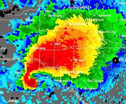
DOW mobile Doppler velocity scan showing the 321 mph wind field directly over Bridge Creek, Oklahoma
The Setup
The SPC had issued a High Risk outlook days in advance. By the afternoon of May 3, a powerful Pacific jet streak had extended over a classic dryline in central Oklahoma, combining with extreme moisture return from the Gulf to produce one of the most tornado-favorable environments ever documented before the event. Multiple supercells initiated along the dryline simultaneously. The Bridge Creek-Moore storm was the southernmost and the most intense. It was mature and producing violent tornadoes before most people had finished watching the evening news.
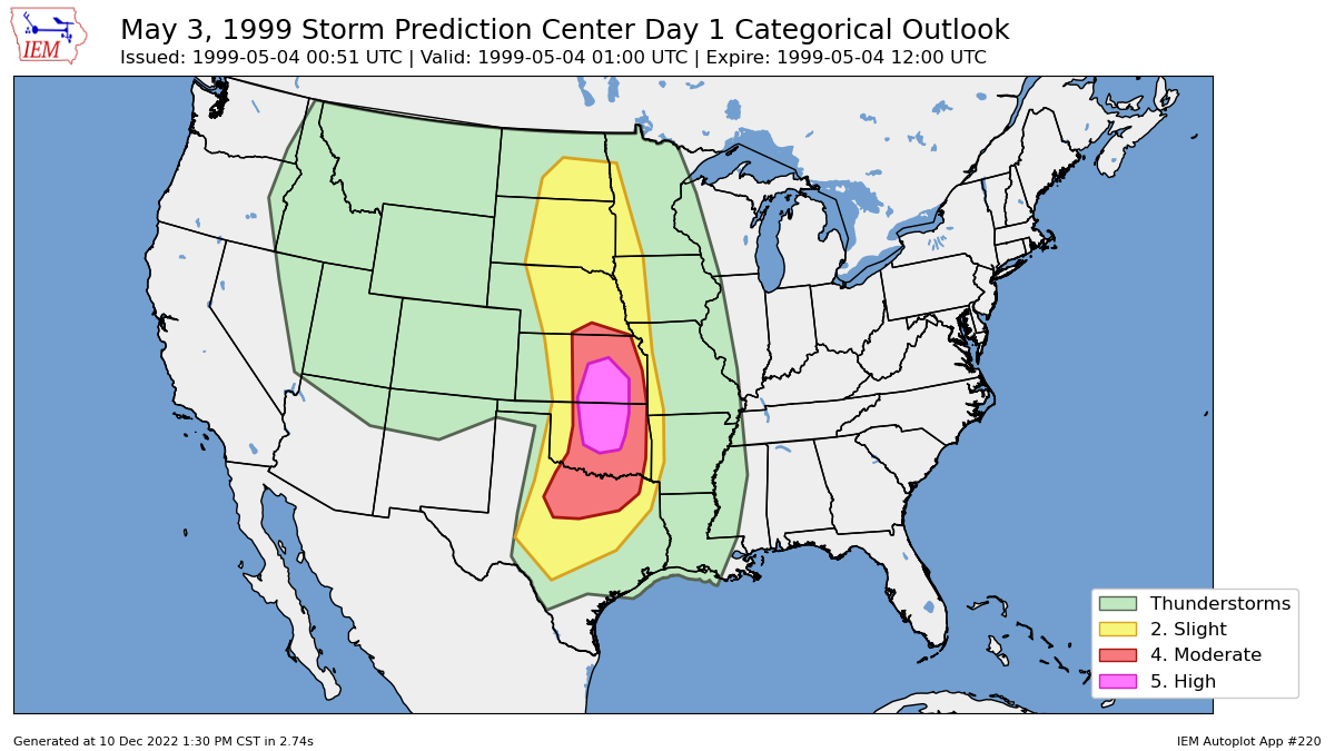
NOAA Storm Prediction Center Day 1 outlook for May 3, 1999, showing a hatched High Risk over central Oklahoma
The Tornado
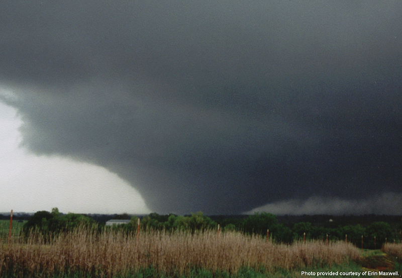
The tornado was a textbook wedge at its maximum. As it approached Moore, it became partially rain-wrapped, obscuring the visible funnel while the wind field continued to expand. In Bridge Creek, homes were not simply destroyed. They were swept clean from their foundations, including the plumbing. Over 8,000 structures were damaged or destroyed along the 38-mile track. The DOW measurement of 321 mph was recorded during the Bridge Creek phase of the storm, before it accelerated into the Moore metro area and began interacting with denser development.
Photograph of the Bridge Creek tornado as a classic wedge moving northeast toward Moore, Oklahoma
The Tornado Emergency
As the tornado moved toward Moore, the NWS forecasters faced a decision. The standard Tornado Warning language had been crafted for routine events. This was not routine. A confirmed violent tornado with measured wind speeds exceeding 300 mph was moving at 35 mph toward a city of 40,000 people. The forecasters issued a Tornado Emergency, a new warning product that used direct, unambiguous language: take shelter immediately, this is a life-threatening event. The language was designed to override the complacency that routine warnings had created in communities repeatedly warned without consequence.
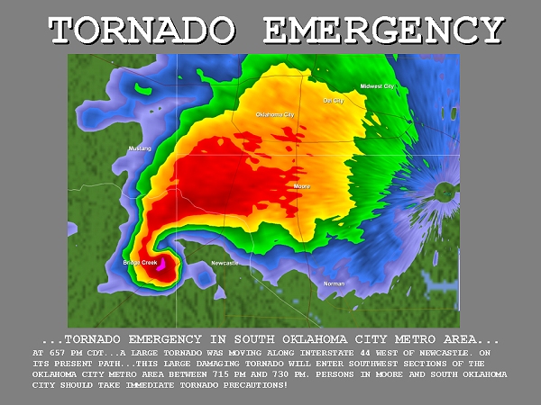
Original National Weather Service Tornado Emergency text for Moore, Oklahoma, May 3, 1999
What Changed
May 3, 1999 became a landmark in tornado science for two reasons. Doppler on Wheels measurements during the Bridge Creek–Moore tornado showed that mobile Doppler radar could capture extreme winds inside a tornado in ways stationary radars and damage surveys could not. The event also strengthened scientific understanding of the upper limits of violent tornado intensity, even though radar measurements and F-scale ratings are not directly interchangeable. On the public safety side, National Weather Service forecasters in Norman introduced the phrase ‘Tornado Emergency’ to signal an exceptional and immediate threat. That wording later became an established part of NWS warning practice for rare, high-end tornado events.
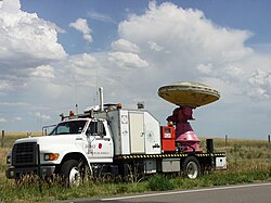
Doppler on Wheels radar truck in deployment position, representing the mobile research radar program