
Culture6 min read
Famous Storm Chasers in History
The scientists and observers who defined storm chasing as both a discipline and a culture. Ted Fujita, Roger Jensen, David Hoadley, and Tim Samaras.
Deep dives into meteorological science, chaser culture, and the art of the intercept.
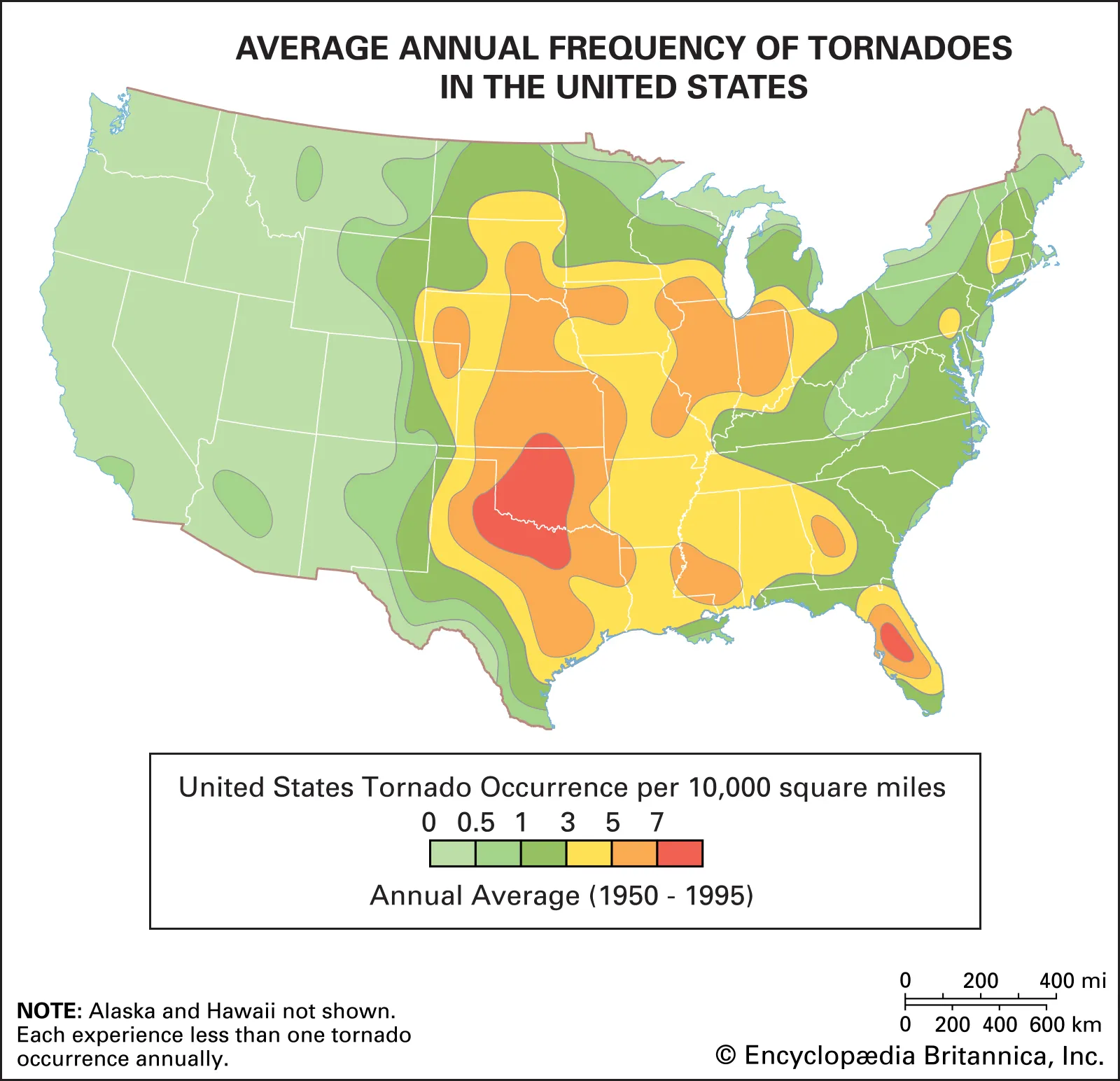
Tornado Alley is a concept, not a boundary line. The geography of severe tornado risk in the United States is more complicated than a stripe on a map, and it is shifting.
The scientists and observers who defined storm chasing as both a discipline and a culture. Ted Fujita, Roger Jensen, David Hoadley, and Tim Samaras.

Most tornadoes form from supercell thunderstorms through a process involving wind shear, a rotating updraft, and a downdraft that concentrates rotation near the ground. Here is how it actually works.

A tornado watch and a tornado warning are not the same thing and do not call for the same response. What each one means, who issues it, and what to do when you receive one.

Asperitas clouds were formally classified in 2017, the first new cloud type added to the International Cloud Atlas in over 50 years. What they are, how they form, and why they are effectively impossible to predict.

Mammatus clouds form through sinking air rather than rising air, making them unusual among cloud types. What they are, how they form, and what they tell you about the storm above.

A mesocyclone is the deep rotating updraft that defines a supercell thunderstorm. How it forms through wind shear, what it looks like on radar, and why most mesocyclones never produce a tornado.

A shelf cloud marks the leading edge of a storm's cold outflow and can look dramatic from the ground. How it forms, what it indicates, and how to tell it apart from a wall cloud.

A wall cloud is a lowered, rotating cloud base that forms beneath a supercell's updraft. How it forms, what it indicates about tornado probability, and how chasers use it for positioning.

The Enhanced Fujita Scale replaced the original Fujita Scale in 2007. What changed, why the wind speed thresholds shifted, and what the damage indicator system actually measures.

Tornado Alley is the informal name for the region of the central United States that produces the highest concentration of tornadoes on Earth. Why it exists, where it is, and whether the traditional definition still holds.

Nighttime tornadoes present unique forecasting challenges and a significantly different risk profile compared to daytime events. Why they are disproportionately dangerous and what they actually look like in the dark.
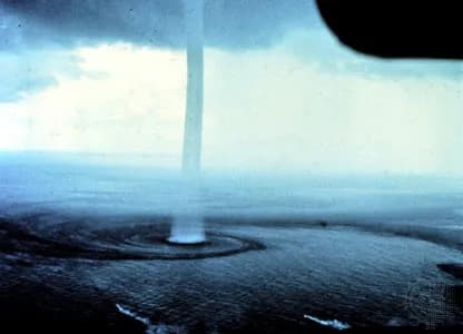
Tornadoes over water. How fair-weather waterspouts differ from their tornadic cousins, where they form, and why the Florida Keys see more than anywhere else on Earth.

The smooth, lens-shaped clouds that form over mountains and get mistaken for spacecraft. How standing waves in the atmosphere create one of the most visually striking phenomena in meteorology.

Enormous electrical discharges above thunderstorms that flash red for milliseconds. How transient luminous events were discovered, what causes them, and why they are almost impossible to see with the naked eye.
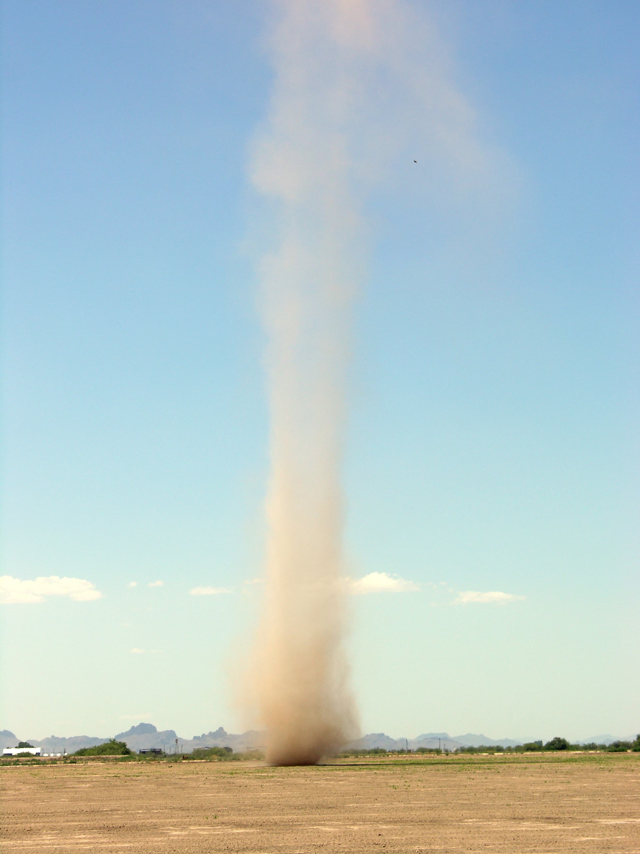
Small, rotating columns of air that form on hot days without any thunderstorm in sight. How surface heating creates vortices, and why they are technically not tornadoes.
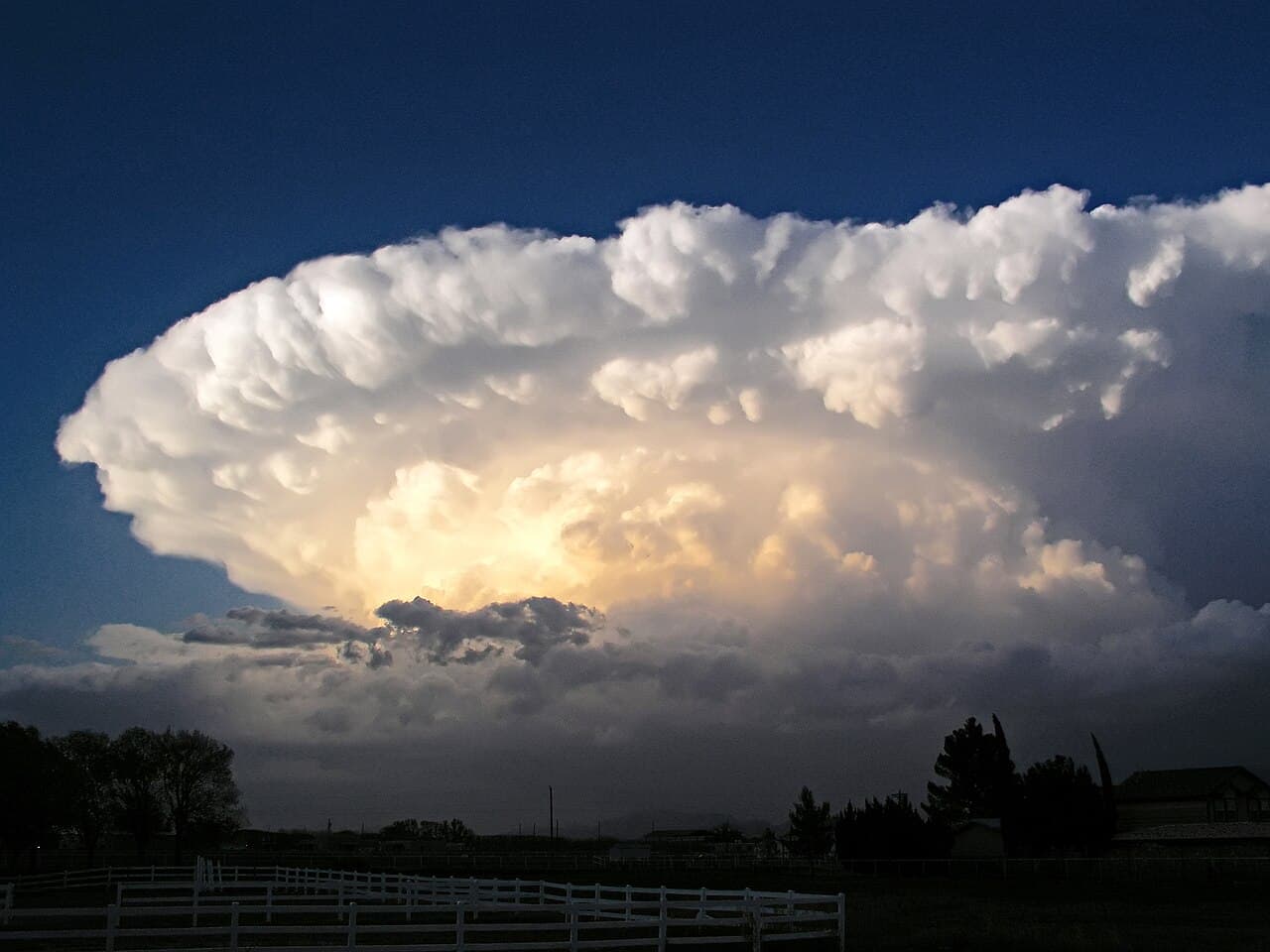
The most organised and dangerous type of thunderstorm on Earth. How supercells form, what makes them rotate, and why they produce the majority of violent tornadoes.

A practical guide to buying for someone who chases storms, written by someone who understands the obsession. No novelty mugs with lightning clipart.

The radar signature that tells forecasters and chasers a storm is doing something serious. How it forms, what it means, and why it became the most recognised symbol in storm chasing.

How Ted Fujita developed the system that classifies tornado intensity, why it was replaced, and what its limitations tell us about the difficulty of measuring something that destroys the instruments.

A gift guide for someone who watches radar for fun, reads METAR reports voluntarily, and owns at least one weather station. Not for casual weather fans.

Rope, cone, wedge, stovepipe, multi-vortex. What the terms mean, how tornadoes get categorised by shape, and why appearance is not a reliable guide to intensity.

What storm chasing actually involves, what you need to learn before doing it, and what to realistically expect from your first season. No dramatic trailer-voice nonsense.