Joplin Tornado 2011: EF5 Deaths, Path Map & Warning Fatigue
The Joplin, Missouri EF5 tornado on May 22, 2011 killed 158 people — the deadliest US tornado since 1936. Explore the 22-mile path, damage timeline, and how it changed tornado warnings forever.
Overview
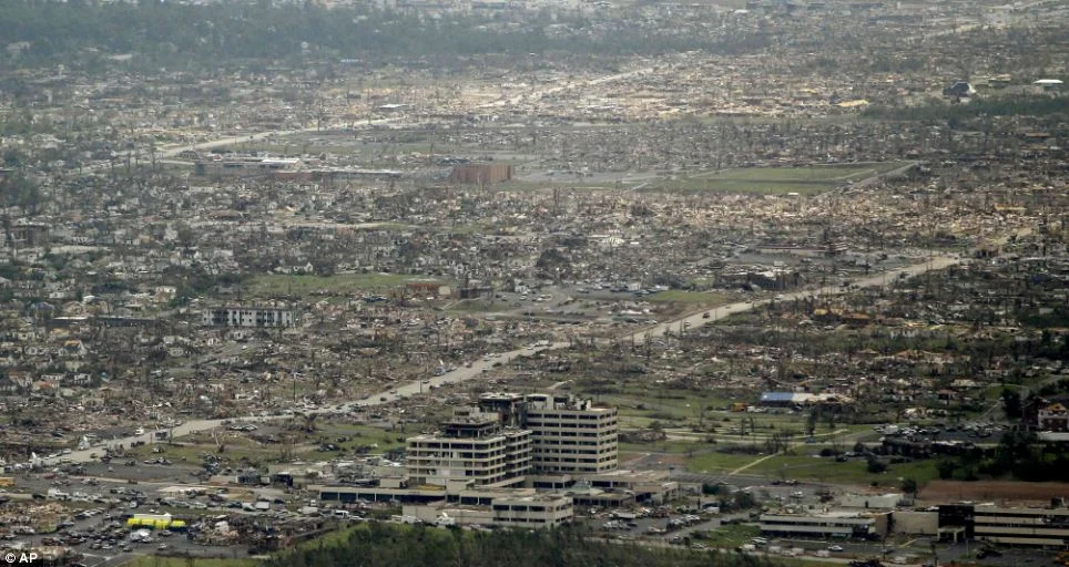
The Joplin tornado of May 22, 2011 killed 158 people, making it the deadliest tornado in the United States since the 1936 Tupelo-Gainesville outbreak. It was an EF5 that tracked 22 miles through the heart of a city of 50,000 at speeds up to 250 mph. The NWS had issued a tornado warning with a 17-minute lead time. Despite the warning, most residents did not seek shelter until they heard the tornado or saw debris. The event forced a fundamental rethink of what tornado warnings are and what they are expected to achieve.
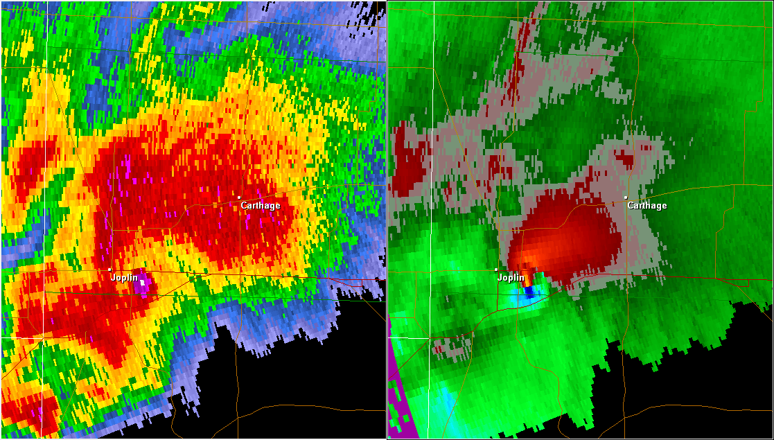
NEXRAD debris ball radar return over Joplin, Missouri, showing lofted building materials visible on radar
The Setup
The setup on May 22 involved a Pacific cold front merging with a secondary surface low over southeast Kansas that drew Gulf moisture into a deep unstable airmass over the Missouri-Arkansas border region. The SPC had issued a Moderate Risk for much of the area, but the specific positioning of Joplin within the most intense shear corridor was not obvious until the supercell had already organized. The storm tracked east-northeast with textbook supercell structure, and the tornado produced from it was immediately violent from the moment of genesis west of the city.
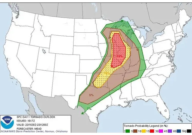
SPC mesoscale discussion map for May 22, 2011, highlighting the risk corridor across southwest Missouri
The Tornado
The tornado was a multi-vortex giant wrapped in heavy precipitation. From inside Joplin, it was described consistently as a wall of blackness that turned the late afternoon into night before residents heard anything. It crossed the city in approximately 20 minutes. St. John's Regional Medical Center, one of the largest buildings in the city, was structurally compromised. The emergency generators failed. Staff and patients sheltered in interior rooms as the walls shifted. On radar, the storm was clearly visible as a debris ball: a region of high reflectivity above the main circulation caused by parts of Joplin being lofted into the atmosphere.
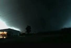
Security camera image from downtown Joplin showing the mile-wide funnel filling the western horizon
Warning Fatigue
The post-event behavioral analysis conducted by NOAA and FEMA was as important as the meteorological survey. Despite a warning issued 17 minutes before impact, a significant portion of residents in the path did not immediately seek shelter. The primary reason cited was familiarity. Joplin and the surrounding region had received routine tornado warnings many times without a significant tornado occurring. The accumulated experience of warning without consequence had conditioned residents to treat the warning as something to monitor rather than act on immediately. In the meteorological community, this was named warning fatigue.
What Changed
Joplin became a major catalyst for the National Weather Service’s move toward Impact-Based Warnings. Under that approach, warnings for the most dangerous tornadoes began using more explicit consequence language, including the potential destruction of well-built homes and the likelihood of thrown vehicles and mass casualties. The goal was to make exceptional risk clearer than standard warning language allowed. Joplin also became a central case study in emergency management and warning-response research, shaping the national discussion about how people interpret tornado warnings and when they choose to act.
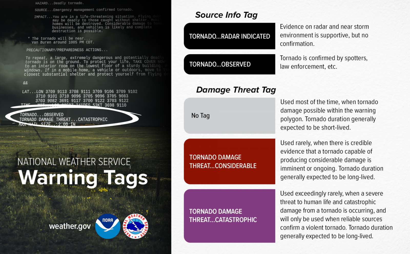
NWS Impact-Based Warning system display showing the Catastrophic Tornado Warning language developed post-Joplin