2021 Mayfield Kentucky Tornado: December EF4 That Shocked America
The Mayfield, Kentucky tornado of December 10, 2021 devastated a town in the middle of winter — a season almost never associated with EF4 tornadoes. Full path, deaths, and timeline.
Overview
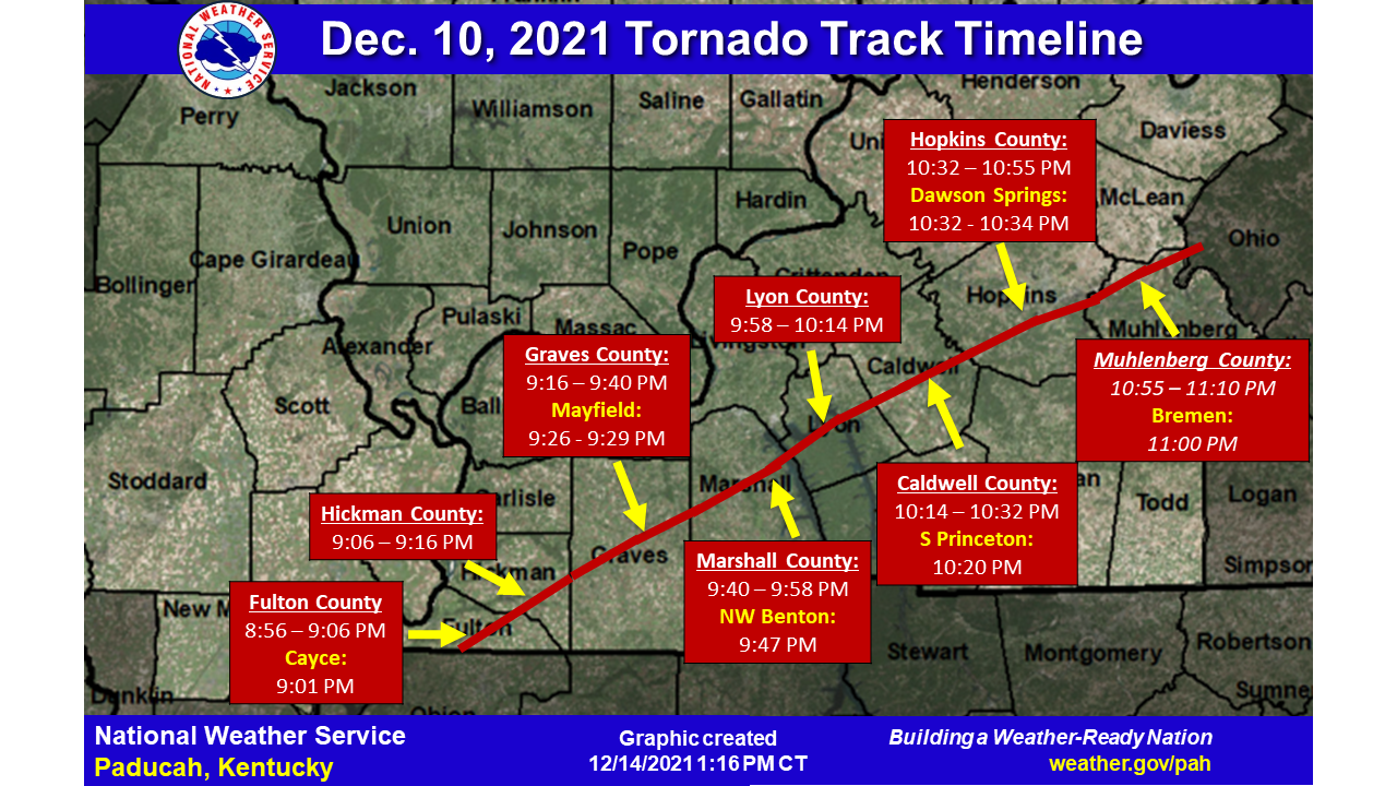
The Mayfield tornado formed in Obion County, Tennessee at 8:49 p.m. on December 10, 2021 and did not lift until 11:48 p.m. in Grayson County, Kentucky. In three hours, it covered 165.6 miles across four states in complete darkness. It struck the historic downtown of Mayfield at 9:26 p.m., killing 57 people in the city and the surrounding county. It also struck a candle factory where workers were on a holiday shift. December tornadoes of EF4 intensity had not been considered part of the operational planning baseline in the region. After 2021, that assumption no longer holds.
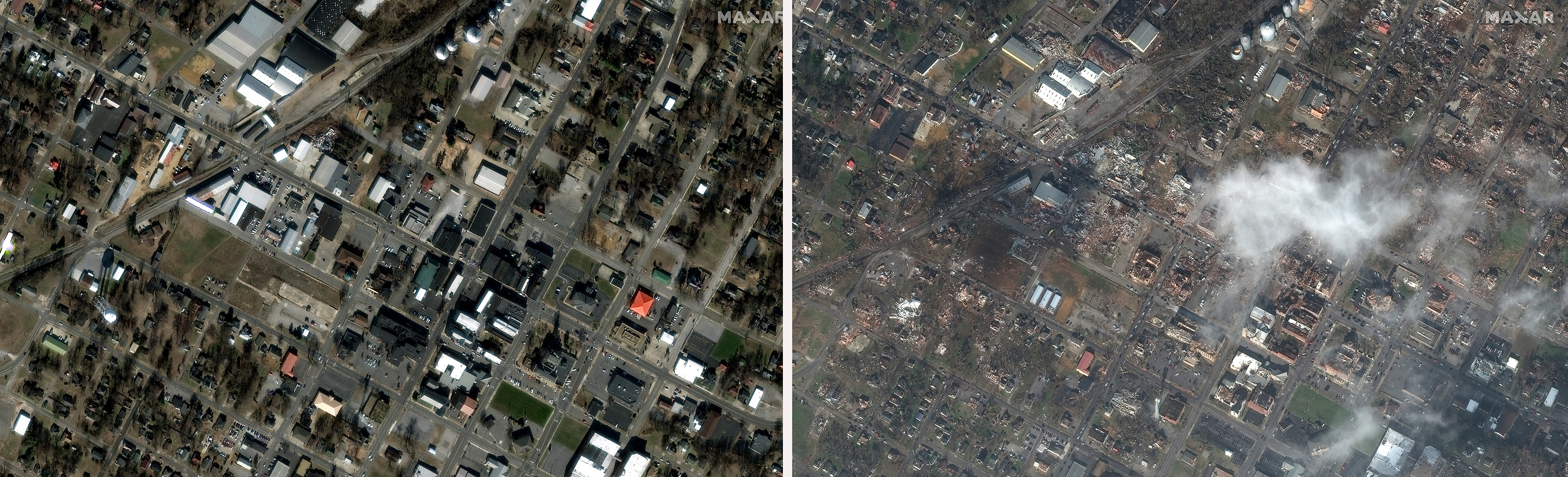
Before-and-after satellite comparison of Mayfield, Kentucky, showing the transformation of the historic downtown
The Setup
The meteorological environment on December 10 was anomalous for the time of year. Surface temperatures across western Kentucky were in the mid-60s Fahrenheit, and the moisture return from the Gulf of Mexico was exceptional for mid-December. A sharp cold front driving southward from the northern Plains produced extreme low-level jet enhancement that created a shear profile comparable to a May outbreak event. CAPE values were modest but sufficient when combined with that shear profile to support sustained supercell rotation. The SPC had issued a High Risk for the region, one of the few times that designation has been issued in December.
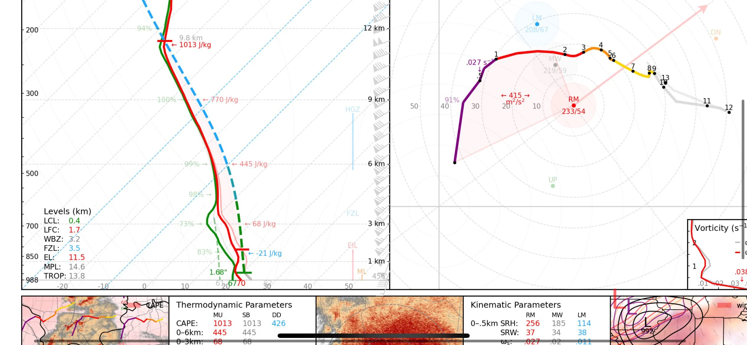
Atmospheric sounding from Nashville showing extreme low-level wind shear and CAPE values for December 10, 2021
The Tornado
The tornado was completely invisible to residents in its path. The combination of nighttime and rain-wrapping meant that the only visual confirmation of its approach was the continuous electrical arcing from destroyed power infrastructure, a phenomenon known as power flashes that shows on radar as bright returns and to the naked eye as a strobing light along the horizon. In Mayfield, the tornado struck on a Friday night in December. Workers in the Mayfield Consumer Products candle factory were on a holiday shift. The building, a large metal structure, failed under the wind load. The collapse trapped dozens of workers inside.
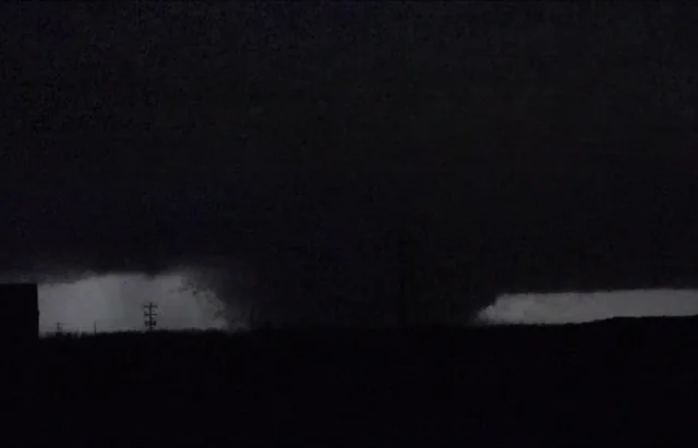
Night exposure photograph from rural western Kentucky showing continuous power flash arcing along the tornado path
A Record Under Dispute
The 165.6-mile path length for the Mayfield tornado is itself the subject of meteorological debate. Some researchers contend that the track represents a single continuous tornado, which would make it the longest path on record since the 1925 Tri-State. Others argue that the NWS track assessment included gaps where the tornado may have briefly lifted. The Tri-State Tornado's 219-mile path is itself contested for similar reasons. The Mayfield event did set an unambiguous record for tornado track length in December and for a December tornado occurring this far north. Regardless of the final disposition of the longer record, its documented 165-mile track is extraordinary by any standard.
What Changed
The Mayfield tornado reinforced that violent, long-track tornadoes are not confined to the spring season and that December outbreaks in the Mississippi and Ohio valleys can produce extreme damage and mass casualties. It became an important late-season case study for forecasting, warning communication, and damage assessment. Researchers also used the Mayfield survey to examine how historic masonry and older commercial buildings perform under tornadic winds, highlighting some of the limits of existing Damage Indicators rather than prompting a formal NOAA revision of the Enhanced Fujita Scale