Tri-State Tornado 1925: 695 Dead, 219 Miles — History's Deadliest
The Tri-State Tornado of March 18, 1925 killed 695 people across Missouri, Illinois, and Indiana in 3.5 hours — the deadliest and longest-tracked tornado in US history. Full path map and archive.
Overview
On the afternoon of March 18, 1925, a single storm system crossed the Mississippi River and carved a 219-mile scar through the heartland of three states. In three and a half hours, it killed 695 people, injured over 2,000, and leveled entire towns. Nothing before or since has matched its length, its death toll, or its sheer scale of sustained violence. The Tri-State Tornado is not simply the deadliest in American history. It is the benchmark against which every other tornado is measured.
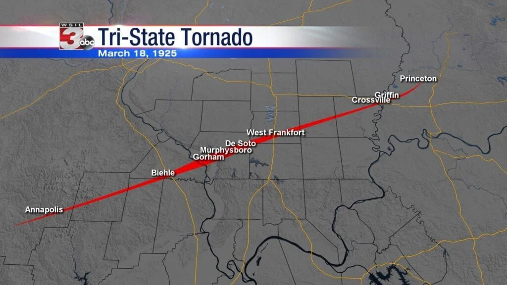
Modern reconstruction map tracing the Tri-State path through Missouri, Illinois, and Indiana
The Setup
The day was defined by a textbook triple-point configuration. A deepening surface low tracked across southeast Missouri, where a warm front extending east met a trailing cold front and a dryline. Gulf moisture had been streaming northward for days, and an upper-level jet streak estimated at 100 knots provided the shear necessary to sustain a supercell for hours. What made this environment particularly lethal was the absence of any meaningful cap. Convection ignited rapidly and without warning, producing a parent supercell that would not exhaust itself for the better part of an afternoon.
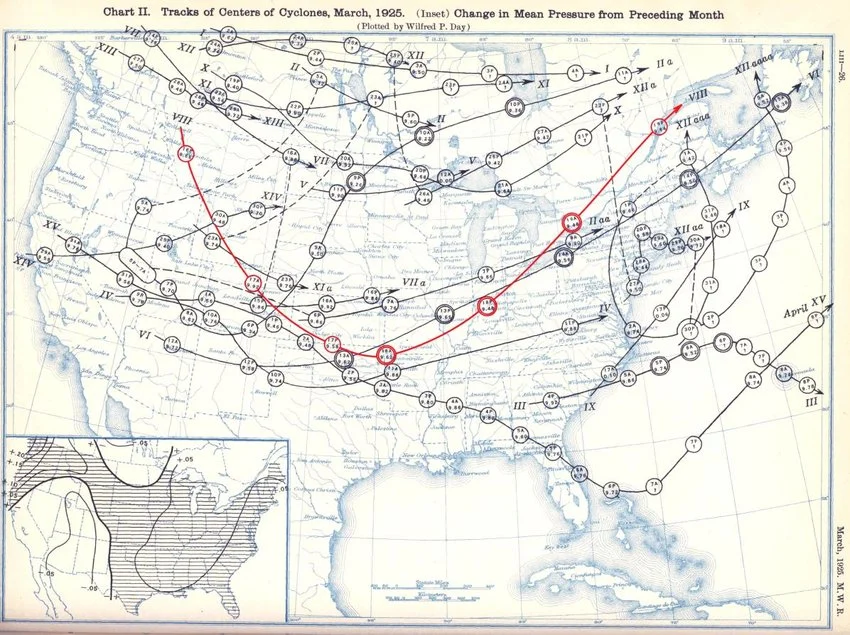
Surface analysis map of the March 18, 1925 synoptic setup over the central United States
The Tornado
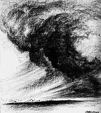
The tornado was deceptive in a way that killed people. It did not look like a tornado. Witnesses consistently described it as a rolling fog, a boiling cloud mass, or a low dark curtain moving at speed. There was no visible funnel descending from the sky, only a wide, dark, featureless wall advancing without sound until it was too close to escape. It moved northeast at 60 to 73 mph, far faster than anyone could run or, in many cases, drive. In Gorham, Illinois, the storm killed 34 of the town's 500 residents in under a minute. In Murphysboro, where 234 died, schools were in session.
Eyewitness sketch of the Tri-State Tornado appearing as a low dark fog over the Illinois landscape
The Scale
Murphysboro, Illinois bore the greatest single-town death toll of any tornado in American history. Two hundred and thirty-four people died there. The town of Annapolis, Missouri was effectively erased; 90 percent of its structures were destroyed. In De Soto, Illinois, 33 children died when their school collapsed. The damage profile was consistent throughout: not just structural failure but obliteration, with entire neighborhoods reduced to bare foundations. In one widely documented case at the Logan School in Illinois, a wooden board was driven into a standing maple tree with sufficient force to support the weight of a grown man.
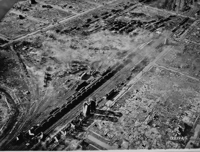
Aerial damage survey of Murphysboro, Illinois showing total destruction across multiple city blocks
One Tornado or Many
The central scientific debate about the Tri-State Tornado has never been fully resolved. Modern re-analysis projects have questioned whether the 219-mile path represents a single, continuous vortex or a family of tornadoes produced by a long-lived parent supercell. The eyewitness accounts are ambiguous. There were gaps in the damage swath and multiple reports of brief lulls. The prevailing scientific consensus leans toward a continuous tornado, but the uncertainty itself is instructive. It catalyzed the creation of the first organized storm observation networks and underscored the need for a centralized weather warning system that would not exist for another three decades.
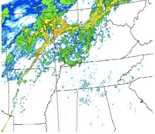
Modern re-analysis radar simulation of the 1925 supercell lifecycle over three states
What Changed
The Tri-State Tornado predates radar, Doppler, the Fujita Scale, and the National Weather Service as it exists today. There were no warnings. People died because nothing in the communication infrastructure of 1925 could get information to them fast enough. The event was the primary catalyst for the Weather Bureau to begin formalizing storm observation protocols and for Congress to fund regional weather stations. It took another fifty years for those efforts to mature into a reliable national warning system. Every significant improvement in tornado forecasting since 1925 is built, in part, on the 695 deaths that day.
Early Weather Bureau telegraph station, representing the first organized warning infrastructure