What is a Supercell?
The most organised and dangerous type of thunderstorm on Earth. How supercells form, what makes them rotate, and why they produce the majority of violent tornadoes.
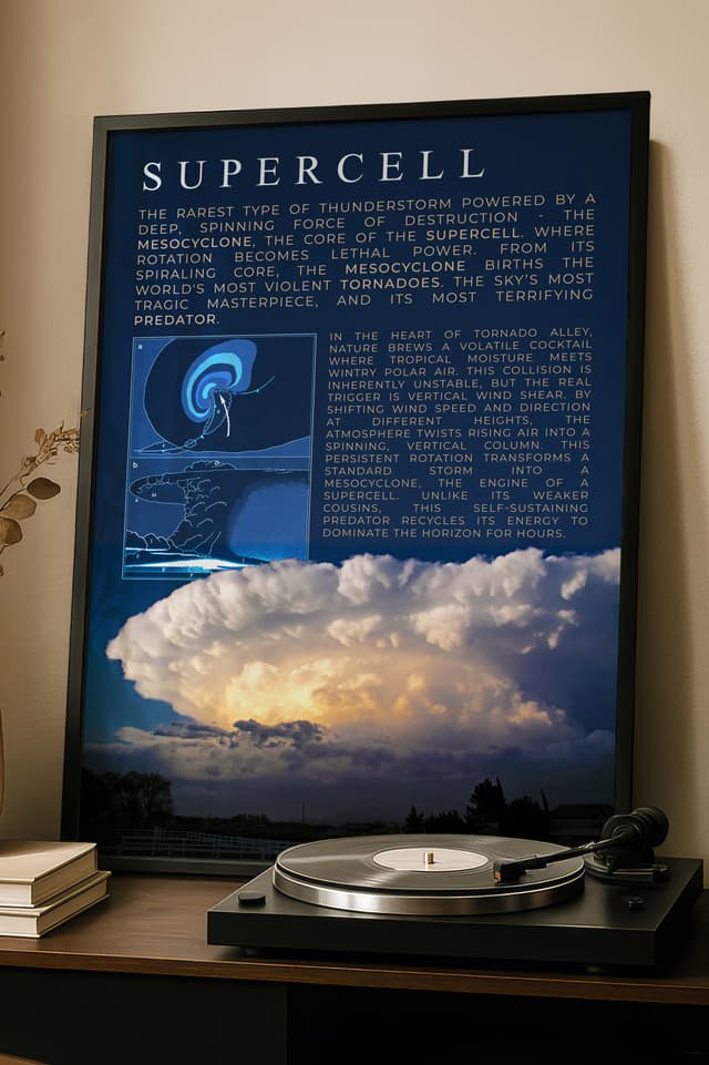
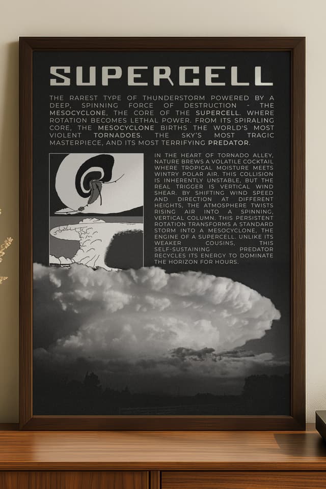
A supercell is a thunderstorm with a deep, persistent rotating updraft called a mesocyclone. It is the most structured and dangerous type of convective storm on the planet. Supercells produce the vast majority of significant tornado types, the largest hail, and the most destructive straight-line winds. Every F5 and EF5 tornado ever recorded was produced by a supercell thunderstorm, including historic events like the 1925 Tri-State Tornado.
How a Supercell Forms
All thunderstorms require three ingredients: moisture, instability, and lift. Supercells require a fourth: wind shear. Specifically, they need strong changes in wind speed and direction with height through the lower and middle troposphere.
When surface winds blow from the south and upper-level winds blow from the west at significantly higher speeds, the difference creates horizontal tubes of rotating air called horizontal vorticity. A developing thunderstorm's updraft tilts these horizontal tubes into the vertical, creating a rotating column of rising air within the storm. This is the mesocyclone, and its presence is what defines a supercell.
The rotation gives the storm organisation that ordinary thunderstorms lack. In a regular thunderstorm, the downdraft produced by precipitation eventually chokes the updraft and the storm dies within 30 to 60 minutes. In a supercell, the wind shear separates the updraft and downdraft spatially, allowing them to coexist. The storm can sustain itself for hours, travelling hundreds of miles while maintaining its structure.
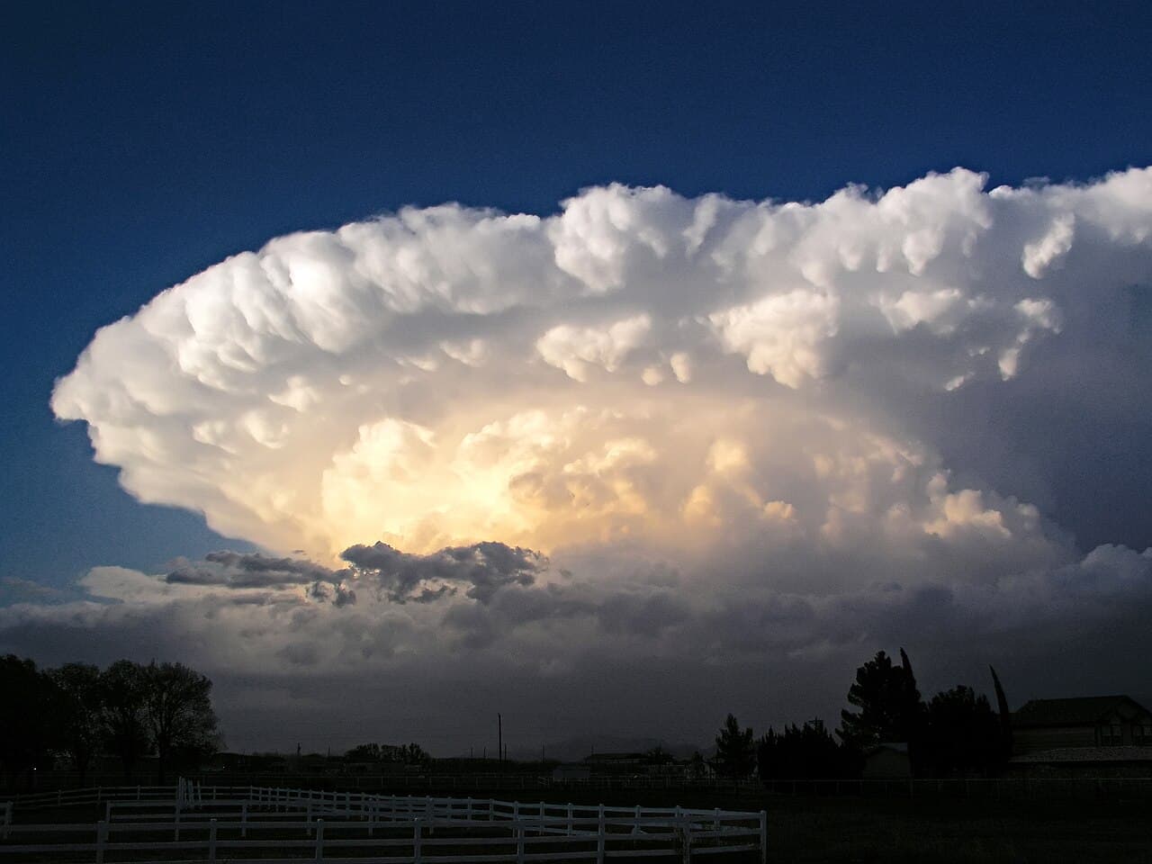
Anatomy of a Supercell
A mature supercell has a distinctive internal structure visible on both radar and visual observation.
The updraft is the engine. Warm, moist air is drawn into the storm from the inflow region at the storm's south and east flanks. Updraft speeds in a strong supercell can exceed 100 mph, powerful enough to suspend grapefruit-sized hailstones aloft for extended periods.
The forward flank downdraft sits ahead of the updraft, where precipitation falls through the storm's forward-moving air mass. This produces the rain and hail that most people on the ground experience as the storm approaches.
The rear flank downdraft wraps around the back side of the mesocyclone. This is the region most directly associated with tornado formation. When the RFD surges and interacts with the low-level mesocyclone, it can tighten the rotation to the point where a tornado develops.
The hook echo is the radar signature produced by precipitation wrapping around the mesocyclone on the storm's southwest flank. Its presence on radar indicates organised rotation and significantly elevated tornado probability.
The anvil spreads downwind from the top of the updraft, often extending 50 miles or more ahead of the storm. An overshooting top, where the updraft punches above the anvil into the stratosphere, indicates an extremely strong updraft.
Why Supercells Produce Tornadoes
Not all supercells produce tornadoes. Roughly 25 to 30 percent do. But when violent tornadoes occur, they come from supercells almost without exception.
The mechanism involves the interaction between the storm's mesocyclone, the rear flank downdraft, and the low-level wind field. As the RFD surges forward and wraps around the mesocyclone, it can concentrate the rotation into a smaller and smaller area near the ground. When this tightening process reaches a critical threshold, a tornado forms beneath the rotating wall cloud.
The process is dynamic and often cyclic. A supercell can produce a tornado, weaken, reorganise its mesocyclone, and produce another tornado. Some storms in the most extreme environments produce tornado families, multiple tornadoes in succession over the course of several hours. The 1974 Super Outbreak and the 2011 Super Outbreak both involved cyclic supercells producing tornado families across hundreds of miles.
Types of Supercells
Supercells are broadly classified into three categories based on their precipitation characteristics.
Classic supercells are the textbook version. They have a clearly defined updraft region, a distinct hook echo on radar, and a visual structure that allows chasers to observe the storm from a safe distance. The precipitation core is offset from the updraft, giving clear views of the wall cloud and any developing tornado.
High-precipitation supercells are wrapped in rain. The precipitation extends around the mesocyclone, often obscuring the tornado completely. HP supercells are dangerous specifically because the tornado is hidden within the rain and can be nearly invisible until it is directly overhead.
Low-precipitation supercells produce minimal rain relative to their rotation. They are visually stunning, often with a sculpted, isolated appearance against clear sky, but they are less common and generally less prolific tornado producers than classic or HP supercells.
Spotting a Supercell
Storm chasers and meteorologists identify supercells through a combination of radar interpretation and visual observation.
On radar, the key signature is the mesocyclone: a couplet of inbound and outbound velocities in close proximity on Doppler velocity data. Combined with a hook echo on reflectivity, this confirms organised rotation within the storm.
Visually, supercells present characteristics that separate them from ordinary storms. The updraft base appears as a lowered, rotating area called a wall cloud. The storm's structure has a sculptural quality, with hard-edged towers and a backsheared anvil indicating a powerful updraft. Experienced observers can read the storm's inflow bands, striations on the updraft tower, and the behaviour of the cloud base to assess the storm's intensity and tornado potential.
We have two supercell prints. They are in the shop.
Archives for storm chasers and meteorology obsessives
Museum-quality prints and technical apparel built on real data. Designed by those who chase.


